
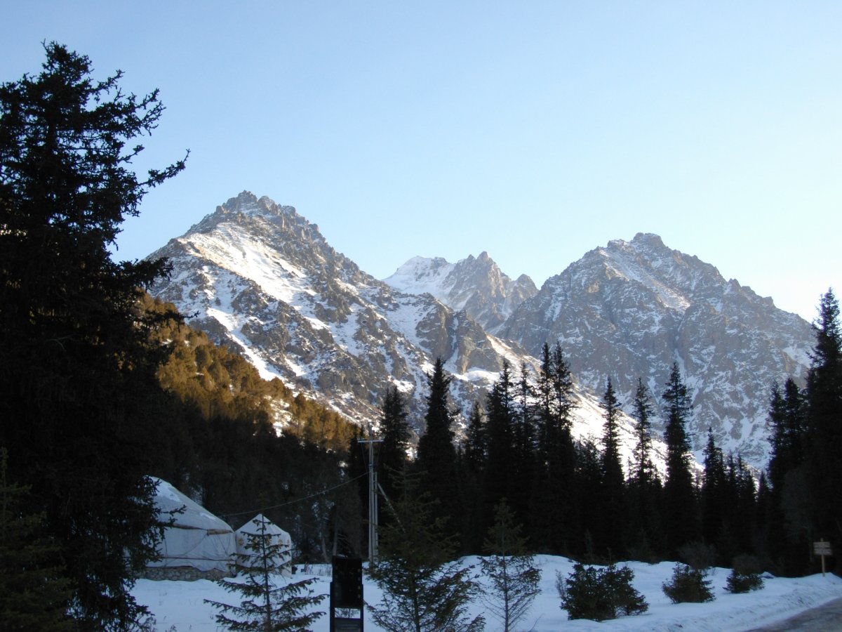

Just 40 kilometers from Bishkek, the capital of Kyrgyzstan, the Ala Archa National Park opens up like a vertical corridor of rock, ice, and forest that quickly rises from the plains of Central Asia to the glacial peaks of the Tian Shan mountain range. The park entrance is accessible year-round, but the higher alpine trails are mainly passable from June to September, when the snow clears the passes. The entrance fee for foreign visitors is around 300-400 Kyrgyz som, a modest amount that grants access to one of the most accessible mountain environments in all of Central Asia.

The park is named after the Ala Archa River, which flows along the valley floor and accompanies the hiker for much of the main trail. The Kyrgyz term Ala Archa literally means "multicolored fir," a reference to the coniferous vegetation that characterizes the mid-elevations of the park, between 1,500 and 2,500 meters. As you ascend, the landscape changes with an almost theatrical rapidity: in just a few kilometers, one moves from the dense green of the forest to the gray of the glacial moraines, and finally to the permanent white of the glaciers.
The main trail to the Ratsek refuge
The most frequented route starts from the main parking lot, near the entrance of the park, and climbs up the valley following the course of the river. The trail is well-marked and ascends with a moderate slope through a forest of firs and larches, where it is common to spot birds of prey and, with a bit of luck, chamois on the higher rocky ridges. After about 7-8 kilometers of walking, you reach the Ratsek refuge, located at about 3,200 meters above sea level, which serves as a base for ascents to the higher peaks of the park.
Along this stretch, the trail crosses the riverbed several times on wooden bridges, some of which show clear signs of seasonal wear caused by spring floods. The sound of the water is constant and deafening during the snowmelt months. The rocky walls flanking the valley rise vertically for hundreds of meters, and on them, the traces left by glaciers during the ice ages are visible: deep grooves, erratic boulders, and moraine deposits that testify to ice movements that occurred millennia ago.
Beyond the refuge: glaciers and high altitude
Those who choose to continue beyond the Ratsek refuge enter a territory that requires mountaineering experience and appropriate equipment. The Ak-Say glacier is the most accessible among those in the park and can be reached with an additional hour of walking on morainic terrain. The surface of the glacier is traversed by crevasses and seracs, and the color of the melting water that flows at its edges takes on shades of intense blue due to the minerals carried by the ice. The highest peaks of the park, such as the Pic Semyonova-Tyan-Shanskogo which exceeds 4,800 meters, are destinations reserved for climbers with a guide.
The atmosphere at these altitudes is rarefied and the sky, on clear days, takes on an almost unnatural blue. Vegetation almost completely disappears above 3,500 meters, leaving space for a lunar landscape of dark rock and snow. In summer, small alpine flowers can be found on the moraines, growing in the crevices between the stones, a detail that surprises every time for the ability of life to adapt to extreme conditions.
How to organize the visit
The most practical way to reach the park from Bishkek is to rent a taxi or a private car, an option that is easily found in the city and takes about 45-60 minutes of travel. Alternatively, there are marshrutkas, the shared minibuses typical of Central Asia, which cover part of the route to the village of Kashka-Suu, but the last stretch to the park entrance still requires a private vehicle or an additional walk.
The best time to visit is between July and August, when the valley temperatures are pleasant and the upper trails are free of snow. It is advisable to leave early in the morning, no later than 8:00 AM, to avoid the afternoon thunderstorms that can quickly form on the peaks in summer and can make exposed sections dangerous. Bringing layered clothing is essential: the temperature can drop by ten degrees in just a few hours of ascent, and the wind on the ridges is often strong even on seemingly warm days in the valley.
What to expect on the trail
The park trails are not marked with the precision typical of the European Alps, but the paths are generally clear and the valley floor does not pose navigation risks. For routes beyond the Ratsek shelter, however, it is strongly recommended to rely on a local guide, available through trekking agencies in Bishkek. These guides know the conditions of the glacier and the safe routes to access it, information that changes from season to season.
The park allows camping in some designated areas of the valley floor, an option that allows you to experience the sunrise on the mountain with the light hitting the snowy peaks first and then slowly descending along the rocky walls down to the valley floor. It is a spectacle that repeats every morning and, unlike many European mountain destinations, can still be experienced in almost total silence.


