


The earth trembles beneath your feet and the air smells of sulfur. The Piton de la Fournaise, which in Creole literally means "peak of the furnace," is one of the most active volcanoes on the planet: it erupts on average once or twice a year, and in certain years even four or five times. When the lava flows towards the Indian Ocean, the landscape transforms into something primordial, almost alien, that no photograph can truly capture.

The volcano is located in the southern part of the island of Réunion, in the territory of Saint-Philippe, and reaches an altitude of about 2,632 meters above sea level. It is part of the Réunion National Park, recognized by UNESCO as a World Heritage Site in 2010. It is not just a mountain: it is a living volcanic system, constantly evolving, that has built one of the most spectacular calderas in the southern hemisphere over the last few centuries.
The landscape of the caldera: what can you really see
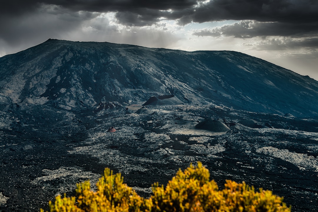
Descending towards the caldera called Enclos Fouqué, the visitor suddenly finds themselves in a desert of black and reddish rock that stretches for kilometers. Vegetation almost completely disappears. The ground is made up of solidified lava flows in different shapes: pahoehoe lava, smooth and wavy like twisted rope, and aa lava, irregular and sharp like broken glass. Walking on these surfaces requires sturdy shoes and constant attention.
At the center of the caldera rises the summit cone, the Dolomieu, which experienced a partial collapse during the great eruption of 2007 — one of the most intense in recent decades — creating a crater over 300 meters deep. When the volcano is in a quiet phase, it is possible to approach the edge of the crater by following the marked trails. The smell of sulfur dioxide becomes stronger as you get closer, and the white fumaroles mark the cracks in the ground like small flags of steam.

The eruptions and their unique spectacle
The Piton de la Fournaise erupts with a frequency that few volcanoes in the world can match. The Volcanological Observatory of Piton de la Fournaise, founded in 1979 and located in Bourg-Murat, monitors seismic activity 24 hours a day and publishes real-time updates accessible online. When an eruption is reported, authorities delineate safety zones and in some cases organize controlled access to allow visitors to observe the lava flows from safe distances.

The most spectacular eruptions are those that reach the coast: the glowing lava pours into the Indian Ocean, producing enormous columns of white steam visible from kilometers away. This phenomenon, locally called lava bench, has extended the island's surface towards the sea over the centuries, and the result can be seen by walking along the Route des Laves, the coastal road that crosses the solidified historical lava flows.
How to organize the visit

The starting point for the excursions is the Pas de Bellecombe-Jacob, reachable by car via the Route du Volcan. From here, the main trail descends into the caldera and leads, in about 3-4 hours of round trip walking, to the summit cone. The path is marked but challenging: the elevation gain is about 500 meters and the uneven terrain requires a good level of fitness.
The most important practical advice is to start at dawn. Clouds tend to envelop the caldera in the late morning, reducing visibility to almost zero. Arriving at the Pas de Bellecombe parking lot around 6:00-6:30 ensures that you will walk at least the first part of the trail with a clear sky and soft light that enhances the color contrasts of the volcanic rock. Bringing plenty of water is essential: there are no sources along the way and the sun reflected off the black rock increases the perception of heat.
Practical Information for the Visitor
Access to the caldera is free, but guided tours with certified guides from the national park have a variable cost that generally ranges from 30 to 60 euros per person, depending on the duration and type of route chosen. The guides know the conditions of the terrain and are updated on the volcanic activity status, which makes their presence advisable especially for those without experience in trekking on lava.
Before departing, it is essential to check the status of the trails on the Observatoire Volcanologique website or on the Parc National de La Réunion portal: in case of eruptive activity or high seismic alert, access to the caldera is closed for safety reasons. This is not an inconvenience, but one of the most fascinating characteristics of the place: the volcano decides when to receive visitors.
