
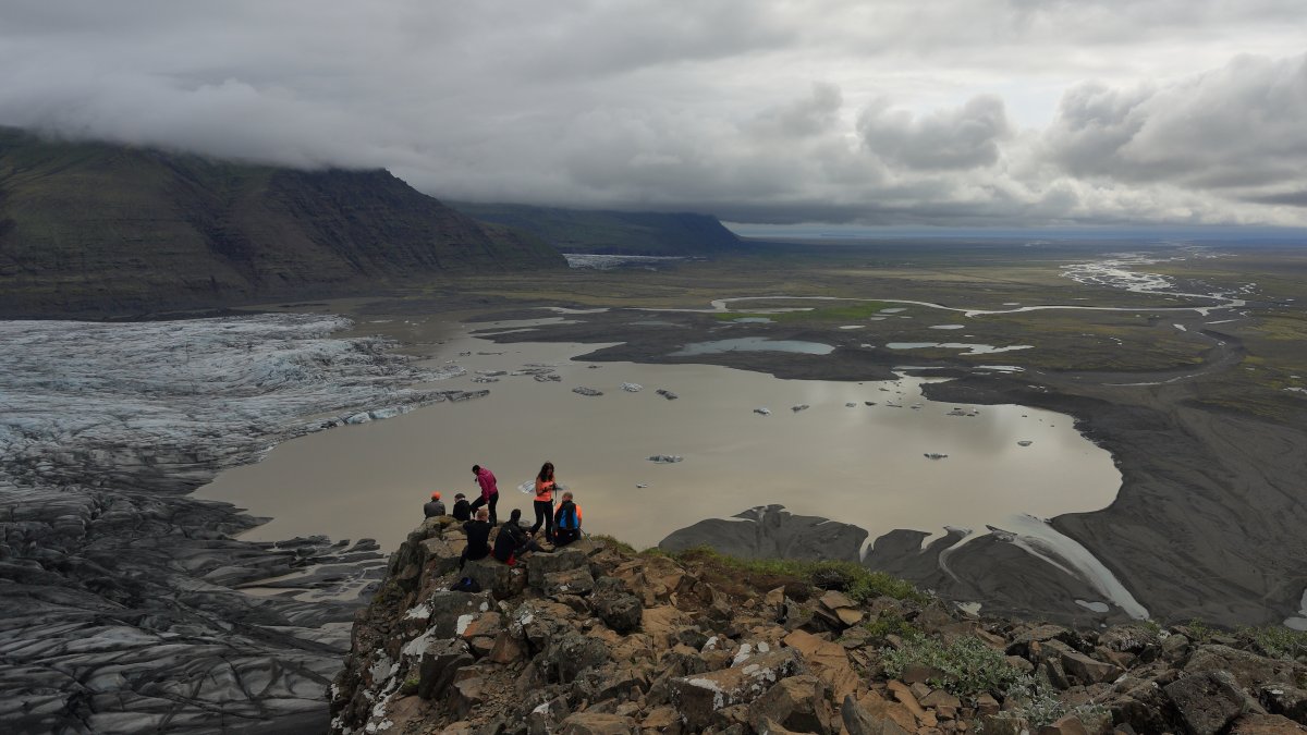

The ice creaks underfoot with a dull and deep sound, while the horizon opens up to a white expanse that seems to have no boundaries. The Vatnajökull National Park, established in 2008 and expanded in 2019 to cover about 14% of Iceland's territory, is dominated by the glacier of the same name: with an area of over 8,100 square kilometers, it is the largest in Europe and one of the most extensive in the Northern Hemisphere. Walking on this mass of ice, which in some places reaches a thickness of 900 meters, is an experience that puts any sense of human scale into perspective.
What makes this park truly unique is not just its size, but the coexistence of opposing geological forces. Beneath the glacier lie active volcanoes, including Grímsvötn, which last erupted in 2011, and Bárðarbunga, which was the site of a long eruption between 2014 and 2015. This permanent tension between volcanic heat and glacial masses creates landscapes that do not exist anywhere else on Earth, including the famous ice caves that form every winter in the depths of the glacier.
The ice caves: a blue world beneath the glacier
The caves that open in the glacial tongue of Vatnajökull, particularly in the area of Jökulsárlón and the glacier Breiðamerkurjökull, owe their electric color to a precise physical phenomenon: the ice compressed for centuries absorbs all wavelengths of visible light except blue, which is reflected outward. The result is a diffuse and surreal light, almost artificial, that envelops the curved walls of the cavities. The caves change shape every year because the summer meltwater carves and modifies them, making each winter season a different experience from the previous one.
Inside the caves, it is possible to observe the dark streaks that traverse the ice: they are layers of volcanic ash deposited by eruptions that occurred centuries ago, a sort of geological archive visible to the naked eye. Each dark stripe corresponds to a specific eruptive event, and glaciologists use them as chronological references to date the formation of the ice.
Fauna and biodiversity: life at the edge of the ice
The fauna of the park is mainly concentrated in coastal areas and in zones where ice meets fresh and saltwater. The glacial lagoon of Jökulsárlón, where ice blocks detach from the glacier and slowly float towards the sea, is one of the best places in Iceland to spot gray seals (Halichoerus grypus), which often rest on drifting icebergs. It is not uncommon to see them slide into the water indifferently while tourists photograph them just a few meters away.
On the cliffs along the southern coast of the park, colonies of puffins (Fratercula arctica) nest, recognizable by their colorful orange beaks and their clumsy yet precise flight. Higher up, in the heath and mossy lava areas surrounding the glacier, reindeer reintroduced to Iceland in the 18th century can often be spotted in small herds in the eastern region of the park. The vegetation landscape, although dominated by mosses, lichens, and dwarf shrubs, hosts a biodiversity adapted to extreme conditions of temperature and wind.
The volcanic landscape: where the earth still breathes
The region of Landmannalaugar, on the western edges of the park, offers one of the most chromatically intense geological views in Iceland: the rhyolite mountains take on shades ranging from ochre yellow to brick red to emerald green, colored by minerals and geothermal activity. The natural hot springs that emerge from the ground allow for bathing in water at around 37-40°C even with external temperatures below freezing, a physical contrast that is hard to forget.
In the area of Askja, accessible through the Icelandic Highlands, lies the volcanic caldera with the lake Öskjuvatn, one of the deepest in Iceland. Next to it, the small crater Víti contains milky white geothermal water, rich in sulfur, in which one can immerse themselves. NASA used this area to train Apollo astronauts in the 1960s, considering it the place on Earth most similar to the lunar surface.
Practical tips for visiting Vatnajökull
The ice caves are accessible only from November to April, when the low temperatures make them stable and safe. Guided tours mainly depart from the town of Höfn or the visitor center of Jökulsárlón, located along the Ring Road (Route 1), the main road that circumnavigates the island. Guided tours to the caves cost on average between 80 and 150 euros per person and last about three hours; it is mandatory to book in advance because spots sell out weeks ahead. To walk on the glacier, it is essential to rely on certified guides: venturing alone on an active glacier, with hidden crevasses and unstable surfaces, poses a real and documented risk.
Those visiting the park in summer can access the Highlands and the Askja area, reachable only by high-profile 4x4 vehicles because the dirt roads cross unbridged river fords. The period between June and August guarantees light until midnight, allowing for extended hikes, but excludes access to the ice caves. Each season reveals a different face of the same territory.


