
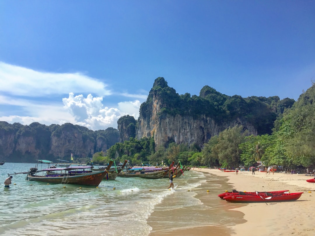

The sweat on the forehead and the burning muscles of the legs: this is how the visit to the East Railay Viewpoint truly begins. The path that climbs from Railay East beach is steep, slippery in the wet season, and wrapped in dense vegetation that does not reveal anything of what awaits at the top. Then, suddenly, the jungle opens up to a rocky plateau and the panorama explodes before the eyes: gray-green limestone towers plunging directly into the turquoise waters of the Andaman, with no beaches in between, no compromises.

The Railay peninsula is located in the Ao Nang district, Krabi province, in southern Thailand. Although geographically part of the mainland, it is completely isolated from the limestone formations that surround it, and the only way to reach it is by boat — typically longtail boats that depart from Ao Nang or Krabi Town. This inaccessibility has preserved Railay from car traffic, making it one of the few beach destinations in Thailand where there is not a single car.
The ascent: what to expect on the trail
The path to the East Railay Viewpoint starts from Railay East beach, the least photogenic part of the peninsula, characterized by a muddy shore unsuitable for swimming. A sign indicates the beginning of the trail, which climbs the limestone hill for about 200 meters of elevation in a very short stretch. It is not a technical trek, but the slope is real: in some places, fixed ropes have been installed to assist the ascent, especially in the sections on bare rock.
The ascent time varies between 15 and 30 minutes depending on physical condition and trail conditions. During the central hours of the day, the heat and humidity make the walk particularly tiring. It is advisable to wear closed shoes with non-slip soles: beach sandals are inadequate and potentially dangerous on rocky sections. Bringing water is essential, as there are no refreshment points along the way.
The panorama: colors and lights at different times of the day
The natural platform at the top offers a 360-degree view that includes both main beaches of Railay — Railay West and Railay East — as well as Phra Nang Beach and its rock formations. The waters of the Andaman change dramatically in hue throughout the day: early in the morning they appear an almost unreal emerald green, while in the central hours they shift to a bright turquoise that contrasts with the gray-beige of the limestone walls.
The sunset perhaps offers the most memorable spectacle. The rock towers, which at certain points exceed 100 meters in height, are tinged with orange and red as the sun descends toward the marine horizon. The silhouettes of the nearby islands — including Ko Poda and Ko Gai, visible from the summit — become dark shapes against a sky that transitions from yellow to purple. A few minutes after sunset, the diffused light creates an almost monochromatic effect that many photographers consider the best moment to shoot.
When to visit and practical advice
The dry season in Krabi is approximately from November to April, with the peak of good weather between December and February. During this period, the trail is drier and the sea is calm, which also facilitates boat access. During the monsoon season, from May to October, the path becomes very slippery and visibility can be reduced by low clouds, although the vegetation takes on more intense colors and the crowds thin out significantly.
The ideal time for the ascent is early morning, around 7:00-8:00, when the temperatures are still bearable and the slanting light creates long shadows on the rock walls. Alternatively, starting about an hour before sunset allows you to witness the change of light from the summit. It is absolutely to be avoided during the central hours between 11:00 and 15:00, when the heat combined with the humidity of the jungle makes the ascent unpleasant. There is no entrance fee for the viewpoint: access is free, but you obviously need to calculate the cost of the longtail boat from Ao Nang, which is around 100-150 baht per person each way.
What to observe upon reaching the top
Once on the plateau, it is worth stopping beyond just taking a photograph. Looking down, you can clearly distinguish the longtail boats leaving white trails on the water, transporting tourists between the beaches. The limestone walls surrounding the peninsula show their porous structure up close, with caves and crevices opening at various heights — some of which are accessible to experienced climbers, as Railay is one of the most well-known rock climbing destinations in Southeast Asia.
In the morning hours, it is common to spot long-tailed macaques along the trail and on the summit platform. The animals are accustomed to human presence and approach without fear, especially if food is in sight: keeping backpacks and bags closed is a necessary precaution. The vegetation surrounding the plateau includes palms, ficus, and climbing plants that cling to the limestone rock, creating a chromatic contrast between the bright green of the leaves and the gray of the stone.


