10 Best Day Trips from Rio de Janeiro — by train, car, and boat
A working guide to getting out of the city before the city gets to you
L
Words by
Lena Hofmann
Updated
2 October 2026
Read time
12 minutes
Includes
7 places · interactive map
Rio de Janeiro is one of those cities that eats your schedule alive. You land with a list — the Tijuca forest, a sunset from Santa Teresa, maybe a caipirinha somewhere with a view — and before you know it, three days have gone by and you've barely left the South Zone. I've made that mistake more times than I care to admit. What changed things for me was learning to treat Rio not as the destination but as the base camp. The mountains, the coast, the colonial interior — all of it is within reach if you're willing to move before 8am and accept that the return journey will occasionally be uncomfortable.
A good day trip from Rio earns its place on this list by satisfying three conditions. First, it has to be genuinely different from what the city itself offers — there's no point in driving two hours to find another crowded beach when Ipanema is twenty minutes away by metro. Second, the logistics have to be honest: if the road is brutal, I'll say so; if the last boat back leaves earlier than the internet suggests, you need to know that before you're stranded. Third, it has to give you enough to fill a day without feeling like a sprint.
The seven destinations in this guide range from wild trails inside Rio's own municipal boundaries to colonial towns that take the better part of a morning to reach. Some are best done by car, some demand a boat, and a couple are accessible on foot if you know where to start. None of them are effortless. All of them are worth it.
Brazil | Pedra Da Tartaruga: the rock that watches the dangerous beach
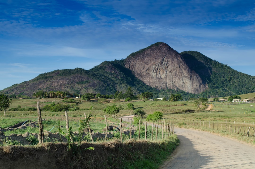
At 42 kilometres from the city centre, Pedra Da Tartaruga sits at the far western fringe of Rio's municipal territory, which already tells you something: this is not the Rio of postcards and beach vendors. The rock — named for its unmistakable resemblance to a tortoise when seen from below — rises above Praia do Perigoso, a beach so remote that it earned its ominous nickname honestly. The trail to the summit is rough, unshaded in stretches, and poorly marked. Plan for roughly two hours of driving from Barra da Tijuca, plus another ninety minutes of hiking each way. What you get at the top is a view over a coastline that looks nothing like the city you left behind: no buildings, no kiosks, no jet skis. Just Atlantic forest dropping into white water. Do the climb early, walk the beach below on the way back, and give yourself time to dry off before the return drive. Bring more water than you think you need — there is nowhere to buy anything out here.
Insider tip
The access road deteriorates significantly after rain. Check the forecast two days ahead, not the morning of. A standard hatchback will struggle on the final stretch; a car with reasonable clearance is a genuine advantage, not a luxury.
The name on the list is Italian-tagged, but the rock itself is emphatically Brazilian. Pedra do Telégrafo sits in the Barra de Guaratiba area on Rio's western extreme, about 43 kilometres from the centre — which in Rio traffic can translate to ninety minutes or two and a half hours depending on when you leave. The grey rock outcrop emerges from dense Atlantic forest like a natural balcony, and the photographs people take here — dangling legs over an apparent abyss — have made it genuinely popular on weekends. That popularity is the main reason to go on a Tuesday. The trail from the trailhead at Pedra Branca State Park takes around two hours at a moderate pace. The reward is a panoramic view over the coast that extends well beyond what any rooftop bar in Ipanema can offer. Arrive before 9am on weekdays and you'll have the ledge largely to yourself. Stay for the late afternoon light if you can — the westward orientation means the last hour before sunset is the best hour to be there.
Insider tip
The Instagram-famous 'hanging over the cliff' shot is an optical illusion — the drop behind the ledge is only a few metres. Don't let the queue for photos eat your entire afternoon. Position yourself, take the shot in under ten minutes, and move on to actually enjoy the view.
These three beaches — Perigoso, Meio, and Funda — exist within Rio de Janeiro's city limits and yet feel further from urban life than many destinations that take twice as long to reach. There are no buildings here, no roads, no infrastructure of any kind. Access is by trail only, which is precisely why they remain in the condition they're in. The hike in is not technically demanding but it is long enough to deter casual visitors, which is the whole point. Praia do Perigoso is the most exposed of the three and can have strong surf; Praia do Meio and Praia Funda are calmer and more sheltered. The sequence makes for a satisfying full-day walk: enter at one end, move through all three, and exit before the light goes. Carry everything you need — food, water, sun protection, a first-aid kit — because you will find nothing on arrival. The reward for this self-sufficiency is a stretch of Atlantic coastline that looks more or less as it did before the city existed at all.
Insider tip
Tides matter here more than almost anywhere else on this list. Check the tide table before you go and plan your beach time around low tide, particularly at Praia Funda, where the walkable beach narrows dramatically at high water.
4Coastal town / beach· 117.6 km
Rio de Janeiro | Pontal and Atalaia beaches: Arraial do Cabo's divided shore
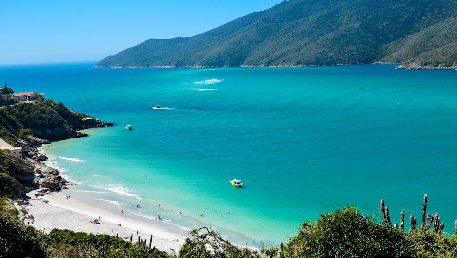
Arraial do Cabo sits about 170 kilometres east of Rio along the RJ-106 — a drive of roughly two and a half hours in light traffic, which means leaving the city no later than 6:30am if you want to avoid the coastal highway backing up around Maricá. The town itself is a working fishing community that happens to sit beside some of the clearest water on the Brazilian coast, a consequence of the Falkland Current pushing cold, nutrient-rich water up from the south. Pontal and Atalaia are technically one beach divided by a rocky promontory, and the difference between them is meaningful: Pontal faces the open Atlantic and gets more wave action, while Atalaia is calmer and better for swimming. Both are worth walking. The town also has a small diving scene if you're certified — the underwater visibility here is exceptional by Brazilian standards. For a day trip, focus on the beaches, walk the promontory between them, and have lunch at one of the simple restaurants on the main street before the drive back.
Insider tip
Arraial do Cabo is extremely popular with Cariocas on summer weekends (December through February). If you go on a Saturday in January, expect the parking areas near the beach to be full by 9am. A midweek visit in the shoulder season — April or May — is a completely different experience.
5Colonial town / history· 162.1 km
Paraty | One of the Oldest Colonial Towns in Brazil: the grid that history forgot to update
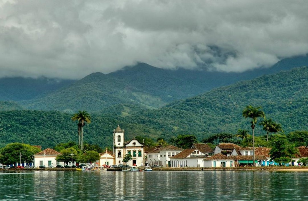
Paraty is 162 kilometres southwest of Rio along the BR-101, the Costa Verde highway, and the drive itself is part of the argument for going: the road runs between the Serra do Mar and the Atlantic, through a landscape of forest and bay that doesn't get boring. Allow two and a half to three hours each way and be honest with yourself about when you need to leave to beat the Sunday evening return traffic, which can be severe. Founded in 1667 by the Portuguese, Paraty served as a key port for gold and later cachaça, and its historic centre was so completely preserved — partly through geographic isolation — that it was designated a UNESCO World Heritage Site. The cobblestone streets are deliberately laid to flood at high tide, which still happens. Walk the centro histórico in the morning before the tour groups arrive, take a boat out into the bay in the early afternoon, and use the last hour before departure to sit somewhere quiet and register what a well-preserved colonial town actually looks and feels like at street level.
Insider tip
The cobblestones in the historic centre are genuinely uneven and slippery when wet. Wear shoes with grip, not sandals. Also: park outside the historic zone — the streets inside are closed to vehicles and the parking situation immediately adjacent is chaotic.
This entry and the one above share a location — Paraty and Parati are the same town, the name varying by spelling convention — but the emphasis here is deliberately different. Where the previous entry focuses on the colonial architecture and the bay, this one is about what surrounds the town: Atlantic forest climbing the Serra do Mar, waterfalls accessible by a short drive or organised jeep tour from the centre, and a coastal mountain landscape that rewards anyone willing to get off the main street. The waterfall circuits around Paraty are genuinely good — cool, clear water, relatively short hikes, and a level of crowd management that makes them viable even in peak season if you go early. The emerald sea of the bay, best seen from a schooner tour, takes on a different quality when you understand it's fed by rivers coming down through intact forest. This is one of the few places on the Brazilian coast where the forest-to-sea transition is still largely unbroken.
Insider tip
Jeep tours to the waterfalls fill up fast in summer. Book the day before at minimum, or first thing in the morning at one of the operators near the bus station. The tours typically run from 10am and return by 3pm, which fits a day-trip schedule if you arrived early.
Getting to Praia Lopes Mendes on Ilha Grande requires commitment, and that commitment is the reason the beach remains in the condition it is. From Rio, drive or bus to Angra dos Reis (roughly two and a half hours), take a ferry or speedboat to Vila do Abraão on Ilha Grande (forty minutes to an hour depending on the vessel), and then hike approximately ninety minutes across the island to reach the beach. The total one-way journey from Rio is four to five hours. I am telling you this upfront because too many people arrive at Angra at noon, do the math, and turn around. The correct approach is to take the first ferry of the day — typically around 8am — which means leaving Rio before 5am. What you find at the end of this effort is a three-kilometre sweep of white sand and calm blue water with no vehicles, no hotels on the beach, and a fraction of the crowd that Búzios or Arraial do Cabo draws on a summer weekend. Ilha Grande is a car-free island; the absence of engines is noticeable and pleasant.
Insider tip
The last ferry back from Ilha Grande to Angra is typically around 5:30pm, but schedules vary by season and operator. Confirm the return time before you set out for the beach — missing the last boat means an unplanned overnight, which is fine if you've budgeted for it and a disaster if you haven't.
There's a version of a Rio trip where you never leave the city and come home satisfied. The city is large enough and varied enough to justify that. But there's another version — the one I keep returning to — where the day trips are what you remember most clearly six months later. The wild beaches at the western edge of the municipality that looked nothing like the city an hour behind you. The cobblestones of Paraty at 8am before the tourists arrived. The ferry cutting across the bay toward Ilha Grande with the Serra do Mar behind it. None of these experiences required a complicated itinerary. They required an early alarm, a willingness to drive or sit on a boat, and the discipline to leave before the day got away from you. Rio rewards that discipline. The coast is long, the forest is deep, and the city — for all its pull — is not the whole story.
🏆 Pocket guide
Take this guide with you.
Save it offline, get walking directions, and discover thousands more places like the ones you just read.
What is the best time of year to do day trips from Rio de Janeiro?
April through June and August through October are the most practical months. The summer (December to February) brings heat, rain, and heavy weekend traffic on the coastal highways — particularly the BR-101 toward Paraty and the RJ-106 toward Arraial do Cabo. July is school holiday season and similarly congested. The shoulder months offer lower crowds, more reliable weather for hiking, and ferry and schooner services that are still running at reasonable frequency. Winter (June to August) is dry and warm by most international standards — perfectly comfortable for beach days and trail walks.
Is there a train service from Rio to any of these destinations?
No. Rio's suburban rail network (SuperVia) connects the city to inland suburbs but does not serve the coastal or mountain destinations on this list. There is no passenger rail to Paraty, Arraial do Cabo, or Angra dos Reis. For Angra (the departure point for Ilha Grande ferries), the most practical public transport option is the bus service from Rodoviária Novo Rio, operated by Costa Verde and similar companies, which takes approximately two and a half hours. For all other destinations on this list, a car is either necessary or significantly more practical than available public alternatives.
What should I know about driving from Rio to the Costa Verde destinations?
The BR-101 south toward Paraty and Angra dos Reis is a well-maintained federal highway through dramatic coastal scenery, but it has significant stretches of single-lane traffic and a number of tunnels and curves that require attention. Speed cameras are frequent. The road is perfectly manageable in a standard rental car — you do not need a 4x4 for the highway itself, though the access roads to some western beaches (particularly near Pedra Da Tartaruga) benefit from ground clearance. Leave Rio before 7am on weekends to avoid the outbound traffic that builds from around 9am. For the return, aim to be back on the highway by 4pm on Sundays — the inbound queue into Rio can add ninety minutes to the journey after that point.
How do I get to Ilha Grande, and can I do it as a genuine day trip?
Yes, but it requires an early start and realistic expectations. Drive or take the bus to Angra dos Reis (two to two and a half hours from Rio), then take a ferry or speedboat to Vila do Abraão on Ilha Grande (forty to sixty minutes). From Abraão, Praia Lopes Mendes is a ninety-minute hike. To make this work as a day trip, you need to be at the Angra ferry terminal no later than 8am, which means leaving Rio by 5:30am. The last ferry back from Ilha Grande is typically around 5:30pm, but verify this with your specific operator before departure — it changes seasonally. Speedboats (lanchas) are faster and more expensive than the standard ferry; they're worth it on the return if you're cutting it close.
Are the wild beaches west of Rio (Perigoso, Meio, Funda, Pedra Da Tartaruga) safe to visit independently?
They are safe in the sense that crime is not the primary concern — these areas are remote enough that they see very few people. The risks are environmental: strong surf at exposed beaches, unmarked trails, no phone signal in many sections, and no services of any kind. Go with at least one other person. Download offline maps before you leave (Maps.me or Google Maps offline works for the trail areas). Carry two litres of water per person minimum, food for the full day, a basic first-aid kit, and a fully charged phone. Tell someone where you're going and when you expect to return. These are not dangerous destinations for prepared adults — they are genuinely problematic for people who treat them like a city park.
🏆 Read this offline
Save it to your phone.
Bookmark this guide, plan your trip offline, and discover thousands of places like these.
BookmarkPlan offline60 languages
iOS / Android
Huawei users
Secret WorldHidden places, real stories — plan your trip