
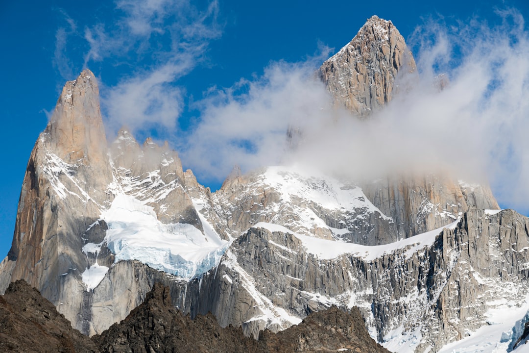

At an altitude of 1,170 meters above sea level, after about four hours of walking on trails that cross lenga forests and windy plains, one of the most extraordinary views of Argentine Patagonia suddenly opens up. The Laguna de los Tres is a glacial lake nestled among the granite rocks of Los Glaciares National Park, and its name refers to the three peaks that dominate it. But it is Mount Fitz Roy — with its 3,405 meters of vertical granite towers — that absolutely steals the show.

The waters of the lagoon are a deep turquoise, colored by suspended glacial sediments, and on clear sky days they reflect the spires of Fitz Roy with an almost unreal precision. Around it, the glaciers clinging to the rocky walls of the surrounding peaks — including Cerro Poincenot and Torre — complete a landscape that seems to have come out of a science fiction movie set on another planet.
Trekking: numbers and elevation not to be underestimated

The trail leading to Laguna de los Tres starts directly from the center of the village of El Chaltén, the youngest village in Argentina, founded in 1985 specifically to assert Argentine sovereignty over this territory contested with Chile. The round trip route measures about 22 kilometers with a total elevation gain of about 800 meters, concentrated mostly in the last steep section that climbs towards the lagoon itself.
This final stretch — a gain of about 400 meters in less than two kilometers — is the most challenging part of the hike and requires attention, especially if the ground is wet or icy. The average duration of the entire hike is between 7 and 9 hours, depending on the pace and breaks. It is not a walk for absolute beginners, but it does not require technical mountaineering equipment either: sturdy hiking shoes, layered clothing, and sufficient water supplies are all that is needed.

What can be seen upon arriving at the lagoon
Once you reach the shore of the lagoon, the view is physically overwhelming. The granite walls of Fitz Roy rise almost vertically for over 2,000 meters from the base, marked by lines of rock that geologists call dikes — intrusions of solidified magma from ancient times. The color of the rock varies from dark gray to rusty red depending on the time of day and the light.

The glacier that feeds the lagoon is visible directly above the water's surface: at certain times, you can hear the dull sounds of ice moving or cracking. The water temperature is close to freezing even in the height of the southern summer, which in Patagonia corresponds to the months of December, January, and February. There are no structures or services on the edge of the lagoon: only rocks, wind, and silence.
The right time to go

The best season to visit the Laguna de los Tres is between October and March, with peak favorable conditions between November and February. In winter, the trail can be snowy and dangerous, and many services in El Chaltén close. But even in summer, Patagonia is unpredictable: the wind can reach speeds over 100 km/h and the sky can go from clear to stormy in a matter of minutes.
The most important advice is to leave early in the morning, ideally by 7:00 or 8:00. This is for two reasons: to avoid crowding on the trail, which can become intense during the central hours of the day, and to increase the chances of finding Fitz Roy free of clouds, which tend to accumulate in the afternoon. Bringing at least two liters of water, enough food for a whole day, and waterproof clothing is simply non-negotiable.
How to get to El Chaltén
El Chaltén is mainly reached by bus from El Calafate, the nearest city with an international airport. The journey takes about three and a half hours on paved roads, with landscapes of Patagonian steppe that are already a visual experience in themselves. Several bus companies operate daily services, with prices varying depending on the season but generally ranging between 3,000 and 5,000 Argentine pesos per trip, subject to changes related to local inflation.
El Chaltén offers a good variety of accommodations, from campsites to guesthouses, but during the high season it is essential to book well in advance. The town is small — with only a few thousand inhabitants — but it is well equipped for trekkers, with equipment shops, restaurants, and a park office where you can get updated information on trails and weather conditions. Entrance to the park is free for foreign visitors, at least according to the policies in place in recent years.


