← Back

Mount Chaberton

Monte Chaberton, 05100 Monginevro, Francia ★★★★☆ 362 views
Lea Marconi
Monginevro
🏆 AI Trip Planner 2026

Get the free app

Discover the best of Monginevro with Secret World — the AI trip planner with 1M+ destinations. Get personalized itineraries, hidden gems and local tips. Free on iOS & Android.

🧠 AI Itineraries 🎒 Trip Toolkit 🎮 KnowWhere Game 🎧 Audio Guides 📹 Videos
Scan to download iOS / Android
Scan for AppGallery Huawei users

About Mount Chaberton

Mount Chaberton - Monginevro | Secret World Trip Planner

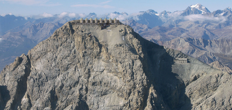
The mountain is located a short distance from the main Alpine chain, in the section where it forms the watershed between the Po and Durance basins, on the side facing Italy; politically it belongs to France for historical reasons. The Chaberton Pass (2,671 m) dominates at the same time the Italian Susa Valley and the French Briançon Valley. Until 1947 it was in Italian territory. Easy excursion on a very panoramic peak, on which there are the remains of the fort destroyed at the beginning of the Second World War. The fort can be visited with the necessary precautions, also for the constant presence of ice inside the buildings. It's a very long hike (15 km round trip) with a good difference in height, but it's made easier by the military road that climbs with a constant slope and never too steeply.

🗺 AI Trip Planner 2026

Plan your visit to Monginevro

Suggested itinerary near Mount Chaberton

MAJ+
500.000+ travelers worldwide
  1. 🌅
    Morning
    Mount Chaberton
    📍 Monginevro
  2. ☀️
    Afternoon
    Lake Gignoux or the seven colours
    📍 7.2 km · Monginevro

Buy Unique Travel Experiences

Powered by Viator

See more on Viator.com

Explore nearby · Monginevro

Frequently Asked Questions

Mount Chaberton belongs to France for historical reasons, despite its proximity to the Italian Alps. The mountain was actually in Italian territory until 1947, when it became part of France as a result of post-World War II border adjustments.
The summit features the remains of a fort that was destroyed at the beginning of World War II, which visitors can explore with necessary precautions. From the Chaberton Pass at 2,671 m, you'll enjoy panoramic views overlooking both the Italian Susa Valley and the French Briançon Valley.
It's a very long hike covering 15 km round trip with significant elevation gain, but it's made easier by a well-maintained military road that climbs at a constant, gentle slope. The consistent grade ensures it's more accessible than it might initially appear despite its length.
The fort can be visited with necessary precautions due to the constant presence of ice inside the buildings, which poses a hazard. Visitors should exercise caution when exploring the interior of this World War II-era structure.
The ascent follows a military road that provides a consistent, never-too-steep gradient all the way up the mountain, making navigation straightforward for hikers. This engineered path significantly eases what would otherwise be a challenging 15 km round-trip hike with considerable elevation change.
Secret World Hidden places, real stories — plan your trip
Get the app