The trail that circumnavigates Mont Blanc, the highest peak in Europe at 4,808 meters, extends for about 170 kilometers crossing France, Italy, and Switzerland. Starting from Chamonix, the classic trek requires 10-11 days of walking and represents one of the most famous alpine routes in Europe, frequented every year by thousands of hikers who face significant elevation changes and landscapes of gray granite, glaciers, and mountain pastures.

The route is not an ascent to the summit, but rather a loop that maintains an altitude of around 2,000-2,500 meters, allowing for views of Mont Blanc from multiple perspectives. The locally managed alpine huts offer overnight stays and hot meals, an essential element for those who do not intend to carry a tent and sleeping bag for over a week of hiking.
The route and the landscapes encountered
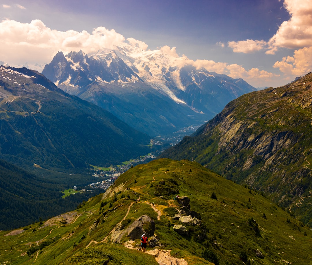
Starting from Chamonix-Mont-Blanc, a French town located at an altitude of 1,037 meters in the Arve valley, the trail quickly ascends towards the Mer de Glace, the largest glacier in the French Alps. In the first days, one traverses coniferous forests that gradually give way to alpine pastures and rocky terrain. Gray granite is the dominant rock: massive outcrops smoothed by glaciation characterize the landscapes above 2,000 meters, where the vegetation becomes sparse and consists of low shrubs and lichens.
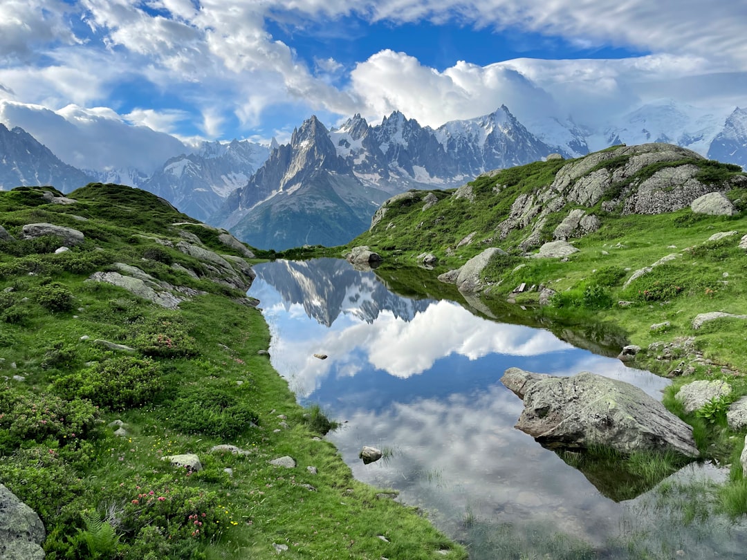
The route touches the Col de la Forclaz de Montmin at 1,461 meters, where the view opens up to the valley below. Continuing towards the Italian side, one reaches areas where granite forms spires and sharp ridges. The glaciers visible from the trail include the Miage Glacier and the Brenva Glacier, both observable up close during the intermediate stages. The Swiss side, reached in the second half of the trek, features gentler landscapes with pastures where cows with bells graze.
The shelters and practical organization
Along the route, there are about 12-15 accommodation facilities, including shelters managed by the Italian CAI, the Fédération Française des Clubs Alpins, and private managers. The shelters offer dormitories with 4-8 beds, shared bathrooms, and dinner with breakfast included. Reservations are strongly recommended during the summer months (July-August), when trekking is more crowded and spots fill up weeks in advance. The average cost for a night in a shelter ranges from 40 to 60 euros, including breakfast and dinner.

The best time for trekking is from June to September, when the trails are completely free of snow. In June, it is still possible to encounter residual snow at the higher passes, while September offers less crowding and more stable temperatures. It is essential to wear sturdy trekking boots with good grip, as the trails on gravel and smooth granite are slippery when wet. Water is generally available along the route from streams and springs, although it is advisable to carry a water bottle for exposed sections.
How to get there and logistics

Chamonix can be reached by train from the Saint-Gervais-Le Fayet station, which is connected to the main French cities. From Geneva, about 100 kilometers away, it is possible to rent a car or use bus services. Access to the trail begins directly from the center of Chamonix, where there is a tourist office that provides detailed maps and advice on available shelters.
For those who do not intend to tackle the entire circuit, there are variants of 5-6 days skipping some stages. The technical difficulty is moderate: it does not require mountaineering equipment, but good physical preparation is necessary given the cumulative elevation gain of about 9,000 meters uphill. Dogs are not allowed on most of the trail, while horses are used for luggage transport by some shelter operators.