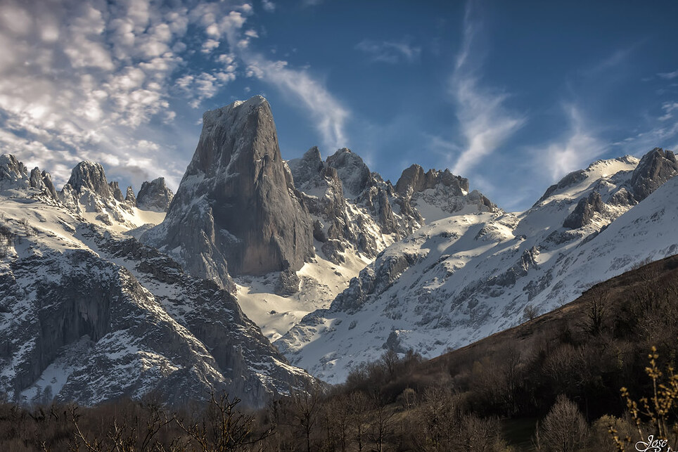
The Naranjo de Bulnes (known as Picu Urriellu in Asturian) is a limestone peak dating from the paleozoic era, located in the Macizo Central region of the Picos de Europa, Asturias (Spain). Its name Picu Urriellu is believed to be derived from the term Los Urrieles which is used to describe the Macizo Central. Naranjo de Bulnes is part of the Cabrales region of Asturias, and lies within the Picos de Europa National Park. The first written reference to "Picu Urriellu" as "Naranjo de Bulnes" is credited to the German geologist and engineer, Wilhelm Schulz, who, in 1855, published the first topographic and geological map of Asturias.The mountain was first scaled from the north face (by the route now known as the Vía Pidal) on 5 August 1904 by Pedro Pidal y Bernaldo de Quirós, marqués de Villaviciosa de Asturias, accompanied by the shepherd Gregorio Perez, called "El Cainejo" from his place of birth, Caín in León.There are many ways to reach the Vega Urriellu area. Probably the easiest way would be to park the car in the town of Sotres. From there, following the track, head for the "Invernales de Cabao", after that cross the Duje river and from there climb up to the "Pandébano Col" where the track ends and the footpath begins. Once on the footpath head towards the "Majada de la Terenosa" (the shelter of the same name is also located there). The "Colláu Vallejo" is reached from here, which is where the route veers to the south and from where you can begin to make out the Picu Urriellu. From that point on the route continues in a zig-zag fashion up to the "Vega Urriellu" where the shelter of the same name is found, at an altitude of 1960m.
The "Pandébano Col" can also be reached from the town of Bulnes, however this town can only be reached using a footpath or the funicular railway.