


In 2010, for almost two months, a column of volcanic ash several kilometers high paralyzed air traffic in Europe, canceling over one hundred thousand flights and stranding millions of passengers at airports. The culprit was an Icelandic volcano with a name almost unpronounceable — Eyjafjallajökull — which rises up to 1,651 meters above the southern coast of Iceland, near the village of Skógar. That eruption, which began on April 14, 2010, was not the most powerful in the island's history, but the direction of the winds and the fineness of the ash made it extraordinarily disruptive for continental aviation.

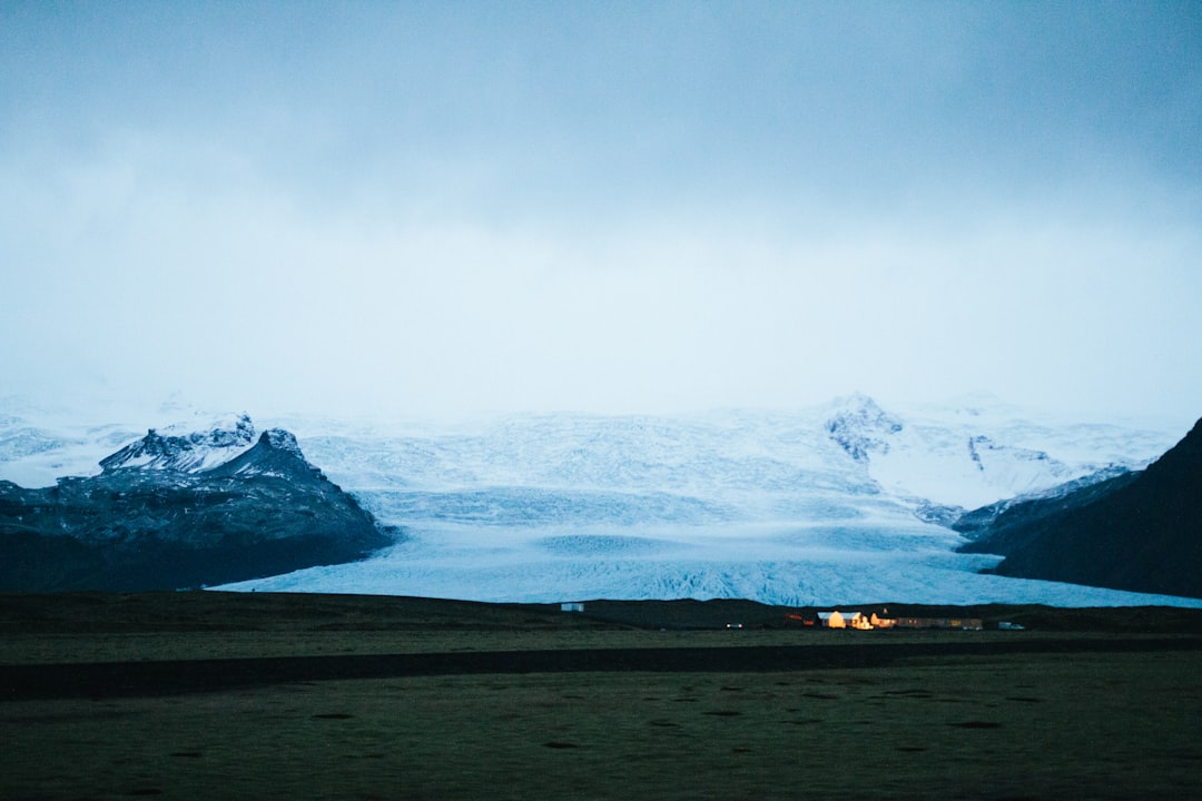
Today the volcano has returned to silence, covered by a glacial cap that reflects the light of the northern sun in shades of white and blue. Walking towards its summit means traversing a landscape that seems to belong to another planet: fields of solidified lava covered in bright green moss, glacial rivers with milky reflections laden with sediments, and valleys carved by millennia of erosion. It is one of the most spectacular treks in southern Iceland, accessible but not trivial.
The route: from Skógafoss waterfall to the glacier cap
The most common starting point for the ascent is Skógar, a small settlement on the Ring Road (National Route 1) about 150 kilometers east of Reykjavík. From here, a path ascends the side of the volcano starting right from the base of the famous Skógafoss waterfall, which is 60 meters high, and whose permanent mist often creates rainbows visible even from afar. The path partly coincides with the famous Fimmvörðuháls, the trekking route that connects Skógar to Þórsmörk through the mountain pass.
As you ascend, the landscape changes radically every hundred meters of elevation. First, you cross green pastures crisscrossed by streams, then you enter a harsher area where the vegetation thins out and black volcanic rock dominates the scenery. Approaching the glacier cap of Eyjafjallajökull — which is itself a glacier covering the summit caldera — the ground becomes unstable and slippery. In some places, it is still possible to observe the signs of the 2010 eruption: layers of tephra, the consolidated volcanic ash, visible in sections of eroded ground.

The ice cap and the summit caldera
Reaching the summit of the volcano requires proper ice equipment and, for most of the year, the use of crampons. The caldera is hidden beneath the summit glacier, which extends for about 100 square kilometers. In optimal visibility conditions, from the top you can see the glacier Mýrdalsjökull to the east — which covers the volcano Katla, geologically related to Eyjafjallajökull — and the Atlantic Ocean to the south.

It is important to know that access to the summit glacial area is not advisable without a mountain guide. Several agencies based in Skógar and Hvolsvöllur organize guided tours with morning departures, which include equipment and expert accompaniment. The main risk is not volcanic activity — the volcano is in a dormant state — but the unpredictable weather conditions and hidden crevasses under the snow.
How to get there and when to go

Skógar can be reached by car via the Ring Road (Route 1) heading east from Reykjavík: the journey takes about two hours. There is no frequent bus service directly to Skógar, but some seasonal lines connect the south coast during the summer months. The ideal month for hiking is between June and August, when the days are very long and the trail conditions are more stable. In winter, the route becomes technically challenging and is not recommended without mountaineering experience.
The trek to the base of the glacier (without climbing to the caldera) typically requires 5-7 hours of round-trip walking, with an elevation gain of over a thousand meters. It is essential to start early in the morning to avoid the often cloudy afternoons and to have a safety margin in case of delays. Bringing plenty of water, layered waterproof clothing, and sturdy hiking boots is essential: the Icelandic weather can change within minutes, even in the middle of summer.
Practical tips for making the most of your experience
Near Skógar is the Skógasafn, an open-air folk museum that collects traditional Icelandic buildings and also offers a small section dedicated to the geological history of the region, including documentation of the 2010 eruption. It is worth visiting before or after the trek to contextualize what you see in the field. Entrance to the museum costs approximately 2,000 Icelandic crowns, but prices may vary.
Those wishing to stay in the area can choose between the Skógar hostel and some rural guesthouses along the south coast. Booking well in advance is essential during the summer months, when the region is very busy also due to its proximity to the Skógafoss waterfall and the Fimmvörðuháls trail. Walking on the Eyjafjallajökull is not just about exercising: it means placing your feet on one of the most well-known volcanoes of recent decades, in a landscape that still bears visible signs of its power.


