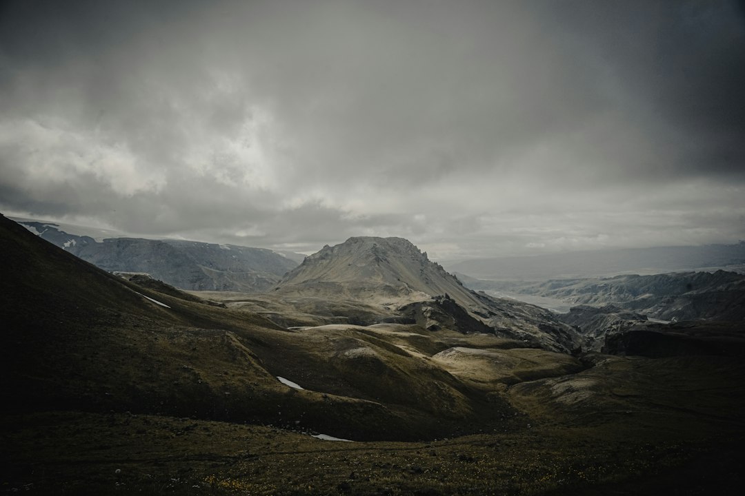

Steam rises again from the cracks in the black rock. A few steps from the path, the lava solidified in 2010 during the eruption of the Eyjafjallajökull volcano forms a lunar landscape that contrasts with the mossy green of the surrounding valleys. Fimmvörðuháls is not just a trekking route: it is a two-day crossing that traverses a still active lava field, connecting the Skógafoss waterfall in the Skógar region with the Þórsmörk valley to the north.
The route stretches for about 25 kilometers in total, with a significant positive elevation gain that takes hikers up to about 1,100 meters above sea level at the mountain pass. Along the way, there are 26 waterfalls in the initial section alone, all fed by the Skógá river, and two volcanic craters born from the 2010 eruption: Magni and Móði, named after the sons of the god Thor in Norse mythology. These craters, still steaming in certain weather conditions, represent one of the rarest and visually striking elements of the entire itinerary.
The departure from Skógafoss and the ascent of the waterfalls
The most common starting point is the Skógafoss waterfall, one of the most famous in Iceland, with its 60 meters in height and 25 meters in width. From here, a metal staircase on the right side of the waterfall allows you to ascend to the upper level, where the path begins to follow the course of the Skógá river upstream. It is in this section that the 26 waterfalls are concentrated: some are small jumps of water between the rocks, while others are true liquid curtains cascading down the side slopes. The ground is damp and slippery, and the black basalt rocks alternate with patches of bright green moss.
As you ascend, the vegetation thins out. Once you surpass 600-700 meters in altitude, the shrubs give way to an increasingly open and wind-swept landscape. In this area, the path is marked by yellow stakes, which are essential during foggy periods, which in Iceland can arrive suddenly even in summer. The boundary between the residual snow and the bare rock is often sharp and surprising.
The lava field of 2010 and the craters Magni and Móði
The central section of the path crosses the lava field formed between April and May 2010, when the Eyjafjallajökull erupted, blocking European air traffic for weeks. Walking on this lava means moving on rock that is less than twenty years old: the surface is uneven, sharp in many places, and the color varies from black to rust red. In some cracks, heat can still be felt, and in cold conditions, steam can be seen rising.
The craters Magni and Móði are located in this area and can be reached with a short detour from the main trail. Their inner walls show layers of lava in different colors, and the interior is still warm. It is not uncommon to find remnants of yellow sulfur on the surrounding rocks. This stretch is the geological heart of the crossing and requires attention while walking, especially with a heavy backpack.
The descent towards Þórsmörk
After the Fimmvörðuháls pass, the trail descends towards the valley of Þórsmörk, a protected area surrounded by three glaciers: Eyjafjallajökull, Mýrdalsjökull, and Tindfjallajökull. The descent is steep and in some places requires caution, but the landscape changes radically: vegetation returns, low birches and wildflowers appear, and the air becomes milder. Þórsmörk can also be reached by jeep from Reykjavík through river crossings, but arriving on foot from the pass gives a very different sense of perspective.
In Þórsmörk, there are huts managed by the Ferðafélag Íslands (Icelandic Touring Club) and the company Útivist, where it is possible to stay overnight. It is in one of these huts, typically halfway or at the end of the first day, that most trekkers stop for the night.
Practical information for those who want to undertake the crossing
The best time to traverse Fimmvörðuháls is from June to September, when the trail is free of snow and the huts are open. In winter, the route is technically very demanding and not recommended without mountaineering equipment. It is strongly advised to book spots in the huts well in advance, especially in July and August, as available spots fill up quickly.
The equipment should include waterproof layers, sturdy-soled hiking shoes, and trekking poles, useful both on the slippery ascent near the waterfalls and on the descent towards Þórsmörk. There are no certified drinking water supply points along the route, so it is necessary to bring a filtering water bottle or plenty of water from home. The total travel time varies between 8 and 12 hours spread over two days, depending on the pace and photo stops.